Yangmingshan - Jinbaoli, Dayoukeng, and the Mt Shiti Trail (金包里大路 , 大油坑 , 頂山石梯嶺步道)
Dayoukeng
The Jinbaoli Trail runs from Qingtiangang to the Jinshan Highway (2申) and is one of the nicest trails I've walked in Yangmingshan. There are also a few interesting hidden sites just off it. It follows an ancient route used by traders on the north coast to reach profitable Taipei markets. It began to be heavily traveled during the Qing Dynasty and was used regularly up until the 1950's. Porters carried fish, tea, and sulfur along this steep path, which must have been hellish in summer. A wider, more meandering path built by the Japanese runs parallel to the trail, overlapping at some points.
Dayoukeng in the distance
The trail used to stretch to Bayan where the wild hot springs are but this stretch is closed due to a landslide. As of 2022 this path is still closed and I think has been unofficially abandoned. The top route to the springs is closed off anyway so all this trail would do really is put you a bit further down the road.
I started from the base of the trail; the Shuanghuang Creek parking lot (easily reached by bus 1717 from Taipei) and walked up to Qingtiangang. Then I came down via the Mt Shiti - Mt Ding Trail to a bus stop at Shengren Waterfall in Shilin. During, I completed the Qingtiangang Loop Trail up to Mt Zhugao. This was a lot of walking for one day but it was enjoyable and mostly downhill after Qingtiangang.
On the edge of Qingtiangang
The trail starts by the vivid orange Shuanghuang Creek. Near the car park there is a small waterfall. Just to the right of this there is a milky blue pool that looks as though it's the color of a hot spring. Looking at Google Earth, the water from the Dayoukeng sulfur vents joins this river somewhere nearby. I can't confirm, but I have some suspicion that there is an undeveloped hot spring in this area, though if there is it would be difficult to access.
Yellow, orange and blue at Shuanghuang Creek. The blue pool is a similar color to the hot spring river at Bayan, though I didn't see any steam here.
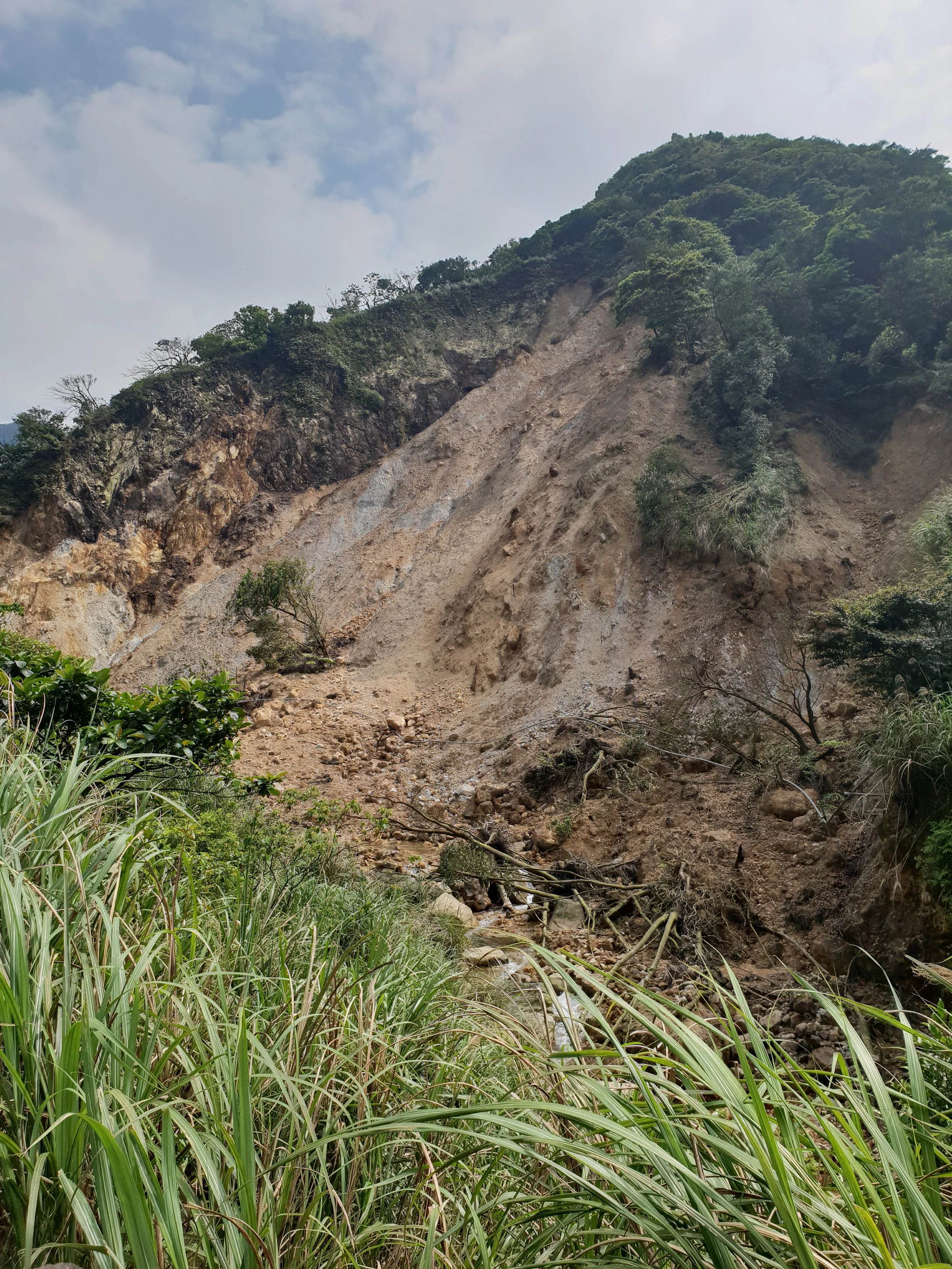
in 2018 there was a huge landslide near the trail entrance, but on the other side of the river
Heading up the steps into a thick forest I came across a small irrigation channel. It led to an artificial waterfall and continued up the river. It was a nice spot, but it didn't lead anywhere particularly special. After reaching the Japanese Trail, the path crosses the narrow Fankeng Waterfall and the pretty Xuyan Bridge from 1896. This was built by the wealthiest tea merchant in Jinshan to help his porters pass the largest river on the trail.
Fankeng Waterfall, Xuyan Bridge, and an old earth god shrine.
Shortly after the bridge there was a fork. The Japanese era trail continued to the left, while the more ancient route headed right. They don't meet again until the grasslands near Qingtiangang. The Japanese Trail contains a small stone quarry, which was used while building the bridge. Behind this, beyond the warning sign, there is a slope down to the river. It looks as though this river would make a beautiful river tracing route. Both trails run through a long abandoned farming village. A few ruined houses can be found, along with numerous overgrown paddy fields. The Japanese trail runs next to a semi-restored house, while the Jinbaoli Trail has a few harder to spot ruins.
The stone quarry and an old residence.
Behind the Hanbing House shelter there is a beautiful trail down through a river valley to the the ruins of the sulfur mine guard camp. I'd already glimpsed the large Dayoukeng crater in the distant grasslands above the forest. It spits out a permanent plume of steam and is much larger than the well known fumerole at Xiaoyoukeng (hence the 'da' in the name). I wanted to find a way to view the crater up close. I didn't know at this point that it's off limits to the public, though in hindsight that explains why there were no marked trails there. Following the trail from Hanbing House I came to a long stone wall. In the Qing dynasty there was such concern about people stealing sulfur, to make gunpowder, that guards were stationed here. The remains of the wall are the only testament left to this.
Part of the guard camp wall.
I felt the vent was close, and now and again smelt the odd rotten egg stench of sulfur. So I headed off on a narrow overgrown trail into the grasslands. I got a bit lost here and ended up going a bit astray, until I found a route through. The ground here can be quite boggy, and I was a little worried about snakes. It wasn't long until I popped out next to the vent with just a few small cuts.
Primary and secondary vents at Dayoukeng, and lost in the grasslands.
The crater is completely bereft of anything living and the main vent makes a violent noise. A boiling stream of water flows down a canyon in the middle and the rocks around it steam. It's an arresting sight and I instantly forgot the trouble getting to it. A cluster of rusted pipes are left from sulfur mining operations. It eventually became too expensive to extract here.
Volcanic edgelands
I found a different route back to the Jinbaoli Trail, passing a sign that I assume said no entry on the way out. This trail was much better kept and easier than the one I entered on. While I don't want to give exact directions here, as really it's a fairly isolated and dangerous place, if you look closely around the abandoned paddy field area it's quite obvious where it starts.
Continuing uphill the trail heads into grasslands, past a rock that looks like a sitting lion. It ends at the Jinbaoli Gate. This was built by the short-lived Taiwanese resistance movement against the Japanese.
The Qingtiangang loop trail is very popular and the crowds are a bit of a shock after Jinbaoli's peace. Mt Zhugao was a nice viewpoint, and the cows were a fun novelty, but both cows and views are also available on the quiet Mt Shiti - Mt Ding Trail which also starts near the Jinbaoli Gate.

Looking towards Keelung Islet
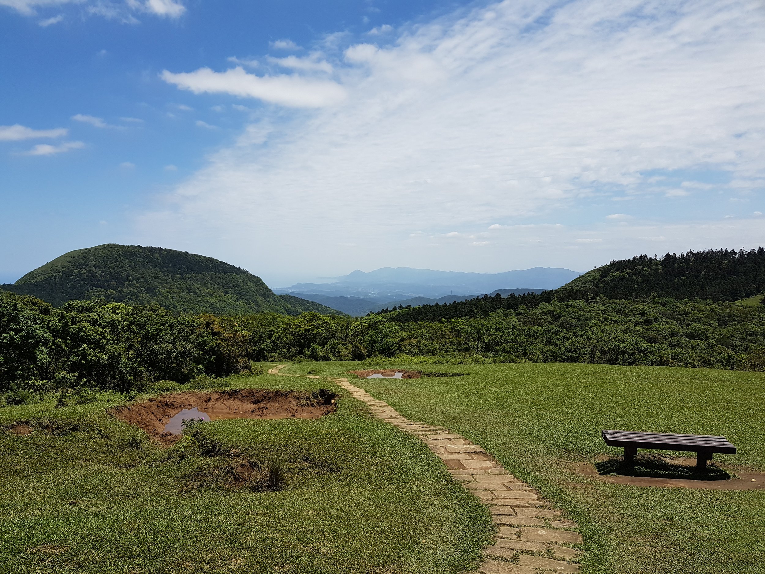
Around the midpoint of the trail
This trail is quite gentle and scenic. The views from Mt Shiti are great and it looks over to the Huangzui volcano in an ecological protection zone (requires a permit to enter). The trail passes through fields of grazing cattle and wildflowers and into a silent stand of Japanese cedar trees. After a steep descent I reached Fengguikou (wind cupboard mouth). This gap apparently acts a a funnel, amplifying the northeast monsoon winds. After finding some steps that cut out the road switchbacks I walked along a quiet valley road to Shengren waterfall. Despite being developed for tourists and tour buses this waterfall is a disappointment. The viewing platform is far from it and cuts the lower half of the falls off. The red 18 bus leaves from a stop nearby and travels to the MRT at Shilin.

The cattle don’t usually come onto the path like this!
Some views from the Mt Shiti - Mt Ding Trail and Shengren Waterfall.
I've plotted the route and a few points on the Hidden Taiwan Map, and I highly recommend the Jinbaoli Trail. It's easily linked with a trip to Bayan Hot Springs, which wrote about here. For this though I’d try and catch a 1717 bus going towards Jinshan from the trail entrance. The adventures that make up these entries are often posted as Instagram stories at tomrookart first. So give that a follow too if you like as it can sometimes be a year or more before stuff turns up here! Please also check out the gallery I keep here!